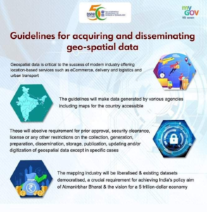
In news- The date, February 15, 2021 is regarded as a watershed moment when new guidelines took effect to completely de-regulate the geospatial sector for Indians.
Key updates-
- During the event commemorating the 1st Anniversary of the Release of Geospatial Data, the Ministry of Science & Technology has stated that Geospatial Policy will be announced soon as the liberalization of the guidelines has yielded very positive outcomes within one year’s time.
- Open call for empanelment of Geospatial companies by Survey of India for mapping 6 lakh villages under the SVAMITVA scheme and the launch of pan-India 3D Maps Program by Genesys International for 100 cities, based on the concept of Digital Twins are historic and revolutionary in nature and will be a game changer decision.
- The size of the Indian Geospatial market in 2020 as per one industry estimate was INR 23,345 Crore including INR 10,595 Crore of export which is likely to grow to INR 36,300 Crore in 2025.
Guidelines on Geospatial Technology-
- The liberalized guidelines on acquiring and producing geospatial data and geospatial data services were issued in February 2021 in supersession of anything to the contrary on the subject issued from time to time by Department of Science and Technology (DST), Ministry of Defense (MoD) and/or any other Department of Government of India vide their various official memoranda and guidelines.
- The Guidelines issued by DST on Geospatial Data and Maps would be the single point reference on the subject.
- The guidelines are applicable to Geospatial Data, Maps, products, solutions and services offered by government agencies, autonomous DST bodies, academic and research institutions, private organizations, NonGovernmental Organizations and individuals.

About Geospatial Technology-
- It is a term used to describe the range of modern tools contributing to the geographic mapping and analysis of the Earth and human societies.
- It is an emerging field of study that includes Geographic Information System (GIS), Remote Sensing (RS) and Global Positioning System (GPS).
- It enables us to acquire data that is referenced to the earth and use it for analysis, modeling, simulations and visualization.
- It allows us to make informed decisions based on the importance and priority of resources, most of which are limited in nature.
Further reading: https://journalsofindia.com/svamitva-scheme/


